Multispectral Drone Remote Sensing for Wetland Preservation
Description:
I approached this project with the goal of creating a practical workflow for collecting and analyzing multispectral data to support wetland preservation. Wetlands respond quickly to changes in temperature, precipitation, and water availability, which makes consistent monitoring essential. Traditional fieldwork is slow and labor intensive, and satellite imagery lacks the resolution and spectral detail needed for small or complex sites. I wanted a method that produced reliable data with minimal manual effort.
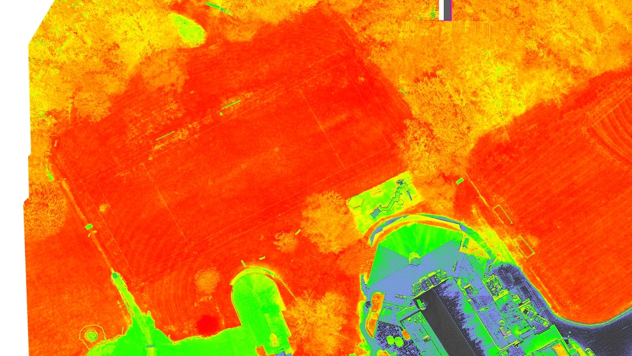
I used a DJI Mavic 3M equipped with both an RGB camera and a four band multispectral sensor. The sensor captures red, green, near infrared, and red edge bands, which are useful for vegetation and water analysis. I used DJI Terra to plan autonomous waypoint missions and to process the collected images. Terra stitched each flight’s images into a single orthomosaic and provided tools for calculating spectral indices.
I collected data on a regular schedule, using automated flights to keep the process consistent. I worked with the Concord Sustainability Department to select sites and align the project with ongoing conservation efforts. After each flight, I processed the imagery in Terra and calculated several indices. NDVI provided a measure of plant health and a rough estimate of chlorophyll. NDWI helped identify water coverage and supported segmentation of wet and dry areas. NDSI allowed me to quantify snow coverage when relevant. I also explored species classification and considered additional applications such as water quality estimation and algae bloom prediction.
The test case at Upper Field showed that the workflow is feasible. The drone collected consistent multispectral data, and the processing pipeline produced usable metrics. The project demonstrated that automated multispectral imaging can support wetland monitoring with far less manual effort than traditional methods. Future work includes cyanobacteria prediction and collecting height data for dredging analysis.
Tools:
All the tools that I used in this project:
DJI Terra Python QGIS